


Lenawee & Hillsdale Counties PUMA, Michigan
About
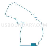
Outline

Summary
| Unique Area Identifier | 193174 |
| Name | Lenawee & Hillsdale Counties PUMA |
| State | Michigan |
| Area (square miles) | 1,368.41 |
| Land Area (square miles) | 1,347.69 |
| Water Area (square miles) | 20.73 |
| % of Land Area | 98.49 |
| % of Water Area | 1.51 |
| Latitude of the Internal Point | 41.89019900 |
| Longtitude of the Internal Point | -84.30361790 |
Maps

Graphs
Select a template below for downloading or customizing gragh for Lenawee & Hillsdale Counties PUMA, Michigan


Neighbors
Neighoring Public Use Microdata Area (by Name) Neighboring Public Use Microdata Area on the Map
- Calhoun & Barry Counties PUMA, MI
- Defiance, Williams, Henry & Paulding Counties PUMA, OH
- Jackson County PUMA, MI
- Lucas (West) & Wood (North Central) Counties--Perrysburg, Sylvania & Maumee Cities PUMA, OH
- Monroe County PUMA, MI
- Noble, DeKalb, LaGrange & Steuben Counties PUMA, IN
- St. Joseph & Branch Counties PUMA, MI
- Washtenaw County (West, Northeast & Southeast) PUMA, MI
- Wood (South), Fulton & Lucas (Southwest) Counties--Bowling Green City PUMA, OH
Top 10 Neighboring County (by Population) Neighboring County on the Map
- Lucas County, OH (441,815)
- Washtenaw County, MI (344,791)
- Jackson County, MI (160,248)
- Monroe County, MI (152,021)
- Calhoun County, MI (136,146)
- Lenawee County, MI (99,892)
- Hillsdale County, MI (46,688)
- Branch County, MI (45,248)
- Fulton County, OH (42,698)
- Williams County, OH (37,642)
Top 10 Neighboring County Subdivision (by Population) Neighboring County Subdivision on the Map
- Sylvania township, Lucas County, OH (48,487)
- Adrian city, Lenawee County, MI (21,133)
- York charter township, Washtenaw County, MI (8,708)
- Madison charter township, Lenawee County, MI (8,621)
- Tecumseh city, Lenawee County, MI (8,521)
- Hillsdale city, Hillsdale County, MI (8,305)
- Raisin township, Lenawee County, MI (7,559)
- Columbia township, Jackson County, MI (7,420)
- Dundee township, Monroe County, MI (6,759)
- Adrian township, Lenawee County, MI (6,035)
Top 10 Neighboring Place (by Population) Neighboring Place on the Map
- Adrian city, MI (21,133)
- Tecumseh city, MI (8,521)
- Hillsdale city, MI (8,305)
- Blissfield village, MI (3,340)
- Clinton village, MI (2,336)
- Hudson city, MI (2,307)
- Jonesville village, MI (2,258)
- Morenci city, MI (2,220)
- Manitou Beach-Devils Lake CDP, MI (2,019)
- Litchfield city, MI (1,369)
Top 10 Neighboring Unified School District (by Population) Neighboring Unified School District on the Map
- Sylvania City School District, OH (52,612)
- Adrian City School District, MI (29,421)
- Saline Area Schools, MI (26,376)
- Tecumseh Public Schools, MI (18,292)
- Steuben County Metropolitan School District, IN (18,053)
- Hillsdale Community Schools, MI (14,748)
- Milan Area Schools, MI (14,409)
- Columbia School District, MI (11,469)
- Onsted Community Schools, MI (9,400)
- Dundee Community Schools, MI (8,731)
Top 10 Neighboring State Legislative District Lower Chamber (by Population) Neighboring State Legislative District Lower Chamber on the Map
- State House District 46, OH (127,690)
- State House District 74, OH (118,430)
- State House District 52, MI (104,679)
- State House District 55, MI (104,306)
- State House District 57, MI (94,159)
- State House District 62, MI (93,343)
- State House District 58, MI (91,936)
- State House District 65, MI (89,787)
- State House District 64, MI (86,288)
- State House District 51, IN (62,592)
Top 10 Neighboring State Legislative District Upper Chamber (by Population) Neighboring State Legislative District Upper Chamber on the Map
- State Senate District 2, OH (363,296)
- State Senate District 1, OH (351,303)
- State Senate District 17, MI (267,269)
- State Senate District 16, MI (253,123)
- State Senate District 19, MI (251,432)
- State Senate District 14, IN (139,068)
Top 10 Neighboring 111th Congressional District (by Population) Neighboring 111th Congressional District on the Map
- Congressional District 3, IN (723,633)
- Congressional District 15, MI (682,205)
- Congressional District 7, MI (676,899)
- Congressional District 5, OH (627,799)
- Congressional District 9, OH (619,010)
Top 10 Neighboring Census Tract (by Population) Neighboring Census Tract on the Map
- Census Tract 617, Lenawee County, MI (9,776)
- Census Tract 92.01, Lucas County, OH (7,860)
- Census Tract 607, Lenawee County, MI (7,083)
- Census Tract 4222, Washtenaw County, MI (7,015)
- Census Tract 64.02, Jackson County, MI (6,995)
- Census Tract 8308, Monroe County, MI (6,759)
- Census Tract 615, Lenawee County, MI (5,742)
- Census Tract 606, Lenawee County, MI (5,385)
- Census Tract 623, Lenawee County, MI (5,301)
- Census Tract 507, Hillsdale County, MI (5,123)
Top 10 Neighboring 5-Digit ZIP Code Tabulation Area (by Population) Neighboring 5-Digit ZIP Code Tabulation Area on the Map
- 49221, MI (41,310)
- 43560, OH (32,226)
- 48176, MI (21,447)
- 49242, MI (15,248)
- 49286, MI (14,797)
- 48160, MI (13,785)
- 49230, MI (10,475)
- 43543, OH (7,771)
- 48158, MI (7,309)
- 46737, IN (7,068)